Delhi’s story is often told in monuments and megaprojects. But another, quieter story lies in its land—the slow shifting of greens and browns into greys. What was once cropland feeding families, wetlands cooling neighborhoods, and forests sheltering birds has, over the last two decades, steadily given way to highways, malls, and colonies.
Maps don’t just capture this transition—they reveal a pattern of choices, each one altering how the city breathes, eats, and survives.
Cropland: The Vanishing Fields
Once, the edges of Delhi were patchworks of wheat, mustard, and vegetables. Villages like Najafgarh, Narela, and Chhatarpur lived in rhythm with harvests. Today, many of those same stretches are covered with residential blocks, warehouses, and concrete flyovers.
This isn’t only a story of food lost. Croplands acted as natural sponges, soaking up rain and recharging groundwater. As they disappeared, Delhi became more dependent on external food supplies and more vulnerable to floods and dry taps. The security of the plate and the aquifer were quietly traded for real estate.
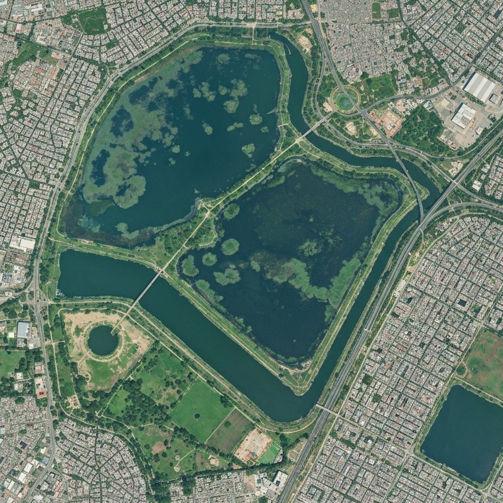
Wetlands: Water Bodies Silenced
The blue patches on older maps—lakes, ponds, and floodplain wetlands—have steadily shrunk. Najafgarh lake is gone. The Yamuna floodplains, once seasonal wetlands, are hemmed in by embankments, metro pillars, and unauthorized constructions.
With them went not just water storage but entire ecosystems. Wetlands moderated temperature, absorbed excess rainfall, and filtered pollutants. Their loss has meant hotter summers, flashier floods, and a river that now carries more sewage than life.
Forests and Scrubland: Chopped, Fragmented, Forgotten
The Delhi Ridge—once called the city’s “green lungs”—is still there, but thinner. Urban sprawl has nibbled away at its edges, cutting corridors where leopards and nilgai once roamed. Forest patches have been fragmented by highways, leaving small islands of green isolated in seas of concrete.
Even scrubland and “barren” areas, often dismissed as wasteland, once played a role—providing grazing grounds, space for recharge, and resilience against dust storms. Their conversion into construction sites removed buffers that protected both people and ecosystems.
Open Spaces to Built Spaces: The Speed of Grey
If cropland and wetlands disappeared slowly, built-up areas surged like a tide. Flyovers rose. Metro corridors carved their way through old neighborhoods. Entire new townships—Dwarka, Rohini, Mayur Vihar—expanded like new cities within the city.
The city needed homes and jobs, yes. But without planning for ecological security, the spread of grey came at a steep cost: rising heat islands, polluted air trapped in concrete canyons, and a city whose “development” eroded the very systems keeping it livable.
Reading the Maps as Warnings
Look closely at the land-use maps from 2000 to 2024 and you can almost read Delhi’s future. Less cropland means more dependence on trucks hauling vegetables from Haryana and UP. Fewer wetlands mean more frequent waterlogging during monsoon and harsher heatwaves. Shrinking forests mean less clean air and fewer climate buffers.
It’s not just about what vanished—it’s about what replaced it. Each red patch of built-up land is not only a house or a road; it’s also a hole in Delhi’s ecological fabric.
What Can Be Done?
The maps are not destiny. They can also guide renewal if read differently.
Protect what’s left: Remaining croplands, wetlands, and forest patches must be zoned as ecological infrastructure, not as “land banks” for future projects.
Reimagine urban land: Vacant lots and degraded lands can be rewilded into community forests, rain gardens, or urban farms.
Mix grey with green: Rooftop farming, rainwater harvesting, and green corridors along roads can bring back some ecological functions lost to construction.
Plan with resilience in mind: Every new building code, highway, or metro extension should be evaluated not just for traffic and jobs, but for its ecological footprint.
The Story We Choose
Delhi’s journey from cropland to concrete is not just an urban expansion story—it is a reflection of choices made without fully valuing ecology. But the next phase of maps doesn’t have to be a continuation of loss.
If the past twenty years have been about trading green and blue for grey, the next twenty could be about weaving them back in. With imagination and policy will, the maps of 2040 could look different—not just dense with concrete, but dotted with restored wetlands, preserved fields, and urban forests.
The pixels on the map are still moving. The question is: will they write a story of erasure—or renewal?
— Sneha 🌱